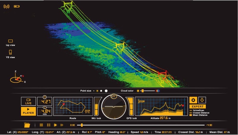
YellowScan is best known for its fully integrated UAV lidar systems, but that doesn’t mean the company isn’t thinking about the software side, too.
At ILMF 2017, YellowScan was on hand demonstrating LiveStation, a real-time monitoring software for performing UAV surveys in the field. The software shows the live point cloud, as well as important flight information, while the UAV survey progresses.
Notably, YellowScan has put a great deal of thought into the visual design of the software, explaining that this was necessary to make it as useful as possible to surveyors out in the field.
SPAR 3D captured a video of YellowScan demonstrating the application so you can get a sense for how it all comes together.