Skip to content

  • Geo Week Event
  • Subscribe

    The information you submit will be stored and used to communicate with you about your interest in Geo Week. To understand more about how we use and store information, please refer to our privacy policy.

  • Lidar

    Lidar Technology

    The latest LiDAR, surveying, mapping, remote sensing, and geospatial technology, focusing on industry innovation & real-world applications.

    • Mobile Mapping
    • SLAM
    • Aerial Mapping
    • Point Clouds
    • Bathymetry
    • Mobile Mapping
    • SLAM
    • Aerial Mapping
    • Point Clouds
    • Bathymetry
    All Lidar Technology
    Hardware
    • Terrestrial Scanners
    • Handheld & SLAM
    • Airborne Sensors
    • UAV-Mounted Lidar
    • Terrestrial Scanners
    • Handheld & SLAM
    • Airborne Sensors
    • UAV-Mounted Lidar
    Resources
    Webinar

    NSRS Modernization is Here: What Surveyors Need to Know Now

    Latest
    • Lidar & Geospatial

    Google Maps Platform Adds AI-Powered Imagery Tools with Implications for Geospatial Workflows

    • April 22, 2026
  • Lidar

    Lidar Technology

    • Mobile Mapping
    • SLAM
    • Aerial Mapping
    • Point Clouds
    • Bathymetry
    • Mobile Mapping
    • SLAM
    • Aerial Mapping
    • Point Clouds
    • Bathymetry
    All Lidar Technology →
    Webinar

    NSRS Modernization is Here: What Surveyors Need to Know Now

    Report

    7 Actions Geospatial Organizations Must Take Now to Stay Competitive

    Hardware
    • Terrestrial Scanners
    • Handheld & SLAM
    • Airborne Sensors
    • UAV-Mounted Lidar
    • Terrestrial Scanners
    • Handheld & SLAM
    • Airborne Sensors
    • UAV-Mounted Lidar
    Latest
    Latest
    • Lidar & Geospatial

    Google Maps Platform Adds AI-Powered Imagery Tools with Implications for Geospatial Workflows

    • April 22, 2026
  • GIS

    GIS & Geospatial

    • GIS & GNSS
    • Mobile Mapping
    • Standards & Regulation
    • Field Data Collection
    • Geospatial Workflows
    • GIS & GNSS
    • Mobile Mapping
    • Standards & Regulation
    • Field Data Collection
    • Geospatial Workflows
    Resources
    Webinar

    NSRS Modernization is Here: What Surveyors Need to Know Now

    Report

    7 Actions Geospatial Organizations Must Take Now to Stay Competitive

    Latest
    Latest
    • Natural Resource Management

    How the Florida Wildlife Corridor Foundation Uses GIS to Save Florida’s Wild Lands

    • April 22, 2026
  • AEC

    AEC / Built Environment

    • BIM & Digital Twins
    • Scan-to-BIM
    • AEC Workflows
    • Construction Tech
    • BIM & Digital Twins
    • Scan-to-BIM
    • AEC Workflows
    • Construction Tech
    Resources
    Webinar

    NSRS Modernization is Here: What Surveyors Need to Know Now

    Report

    7 Actions Geospatial Organizations Must Take Now to Stay Competitive

    Latest
    Latest
    • AEC Innovations, Press Release, Urban Planning & Development

    Eagleview Launches Eagleview Horizon: The Agentic AI Engine Powered by 25+ Years of Verified Property Intelligence

    • April 29, 2026
  • AI

    AI & Machine Learning

    • Point Cloud AI
    • Foundation Models
    • Geospatial ML
    • Automation & Robotics
    • Point Cloud AI
    • Foundation Models
    • Geospatial ML
    • Automation & Robotics
    Resources
    Webinar

    NSRS Modernization is Here: What Surveyors Need to Know Now

    Report

    7 Actions Geospatial Organizations Must Take Now to Stay Competitive

    Latest
    Latest
    • AEC Innovations, Press Release, Urban Planning & Development

    Eagleview Launches Eagleview Horizon: The Agentic AI Engine Powered by 25+ Years of Verified Property Intelligence

    • April 29, 2026
  • Reality Capture

    Reality Capture & 3D Scanning

    • Photogrammetry
    • Point Clouds
    • 3D Visualization
    • Laser Scanning
    • Photogrammetry
    • Point Clouds
    • 3D Visualization
    • Laser Scanning
    Resources
    Webinar

    NSRS Modernization is Here: What Surveyors Need to Know Now

    Report

    7 Actions Geospatial Organizations Must Take Now to Stay Competitive

    Latest
    Latest
    • AEC Innovations, Press Release, Urban Planning & Development

    Eagleview Launches Eagleview Horizon: The Agentic AI Engine Powered by 25+ Years of Verified Property Intelligence

    • April 29, 2026
  • Drones

    UAV / Drone Technology

    • Aerial Mapping
    • Drone Regulations
    • Sensor Payloads
    • BVLOS Operations
    • Aerial Mapping
    • Drone Regulations
    • Sensor Payloads
    • BVLOS Operations
    Resources
    Webinar

    NSRS Modernization is Here: What Surveyors Need to Know Now

    Report

    7 Actions Geospatial Organizations Must Take Now to Stay Competitive

    Latest
    Latest
    • AEC Innovations, Press Release, Urban Planning & Development

    Eagleview Launches Eagleview Horizon: The Agentic AI Engine Powered by 25+ Years of Verified Property Intelligence

    • April 29, 2026
  • Earth Observation

    Earth Observation & Remote Sensing

    • Remote Sensing
    • Satellite Imagery
    • Sustainability & Climate
    • Remote Sensing
    • Satellite Imagery
    • Sustainability & Climate
    Resources
    Webinar

    NSRS Modernization is Here: What Surveyors Need to Know Now

    Report

    7 Actions Geospatial Organizations Must Take Now to Stay Competitive

    Latest
    Latest
    • AEC Innovations, Press Release, Urban Planning & Development

    Eagleview Launches Eagleview Horizon: The Agentic AI Engine Powered by 25+ Years of Verified Property Intelligence

    • April 29, 2026
  • Industries

    Type your paragraph here

    Type your paragraph here

    Type your paragraph here

  • Resources

    Type your paragraph here

    Type your paragraph here

    Type your paragraph here

  • February 15, 2026

Geo Week Spotlight: Pointerra3D Launches the Digital Surveyor Bundle with Exclusive Offer

  • "Surveyors shouldn't have to choose between enterprise capability and affordability."
Guest Author

Guest Author


  • February 15, 2026


  • Sponsored

SHARE

Get the latest geospatial news delivered to your inbox every week.

Subscribe

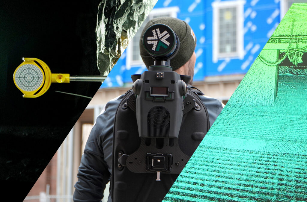
Cloud adoption continues to reshape the geospatial industry, but for many independent surveyors and growing firms, accessing enterprise-grade tools has traditionally meant navigating complex desktop workflows or significant upfront investment. 

At Geo Week 2026, Pointerra3D is showcasing a different approach with the launch of its Digital Surveyor Bundle—recently voted a Geo Week 2026 Game Changer by attendees. 

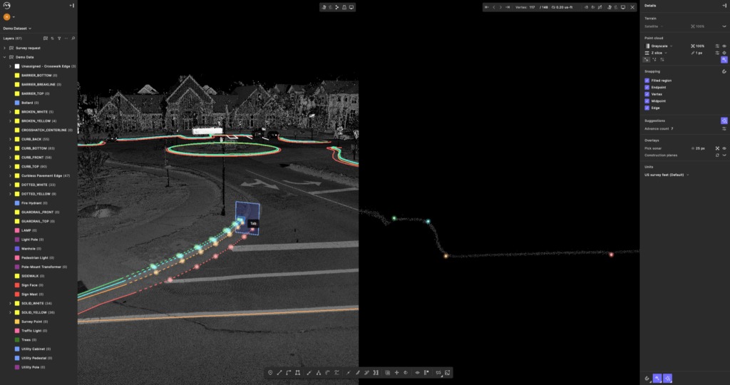
The bundle combines cloud-native imagery and lidar management with flexible, configurable analytics in a single ultra-fast environment. Surveyors can store, visualize, annotate, and analyze large-scale reality datasets directly in the cloud—applying advanced analytics on a project-by-project basis, without fixed software licenses or heavy desktop processing. 

According to the Pointerra3D team, this flexibility is central to the bundle’s value. 

“Surveyors need the ability to scale analytics and better allocate project costs,” explains Brian Mayfield from Pointerra “Now they can not only enhance their service offering, but invoice faster and ultimately win more work.“ 

The Digital Surveyor Bundle supports enterprise-style project delivery without the infrastructure burden. The impact is measurable. By centralizing data and analytics in a browser-based environment, teams significantly reduce processing bottlenecks, streamline collaboration, and accelerate turnaround times. 

To mark both the launch and the accolade, Pointerra3D is offering a limited Geo Week bonus. Surveyors who start a 30-day trial before the show ends on February 20 and subscribe before the end of the trial will receive double storage and additional processing capacity to support advanced analytics workflows. 

Learn more at: https://www.pointerra.com/product/digital-surveyor-bundle/  or visit the team at booth 1133 for a live demo.  

TAGS

About the Author

Guest Author

View more from

Guest Author

Related

  • Sponsored, Upcoming Live Webinar

Fast, Accurate, or Both? The Reality Capture Tradeoff No One Explains

  • April 9, 2026
  • Sponsored

Mach9 Unveils an AI-Assisted Workflow Focused on Trust and Control at Scale

  • February 10, 2026
  • 3D Technology, Lidar & Geospatial, Sponsored, Urban Planning & Development

How Centralized Geospatial Data Access Is Transforming 3D City Modeling

  • February 9, 2026

Most Read

Don’t Be Scared of NSRS Modernization, Be Prepared

  • April 1, 2026

How the Florida Wildlife Corridor Foundation Uses GIS to Save Florida’s Wild Lands

  • April 22, 2026

Smarter Roads, Safer Mines

  • March 18, 2026

Around the Geospatial, 3D, and AEC Industries: Hidden Islands, Workforce, and City Planners

  • May 4, 2026

Get the latest geospatial news delivered to your inbox every week.

Subscribe
X-twitter Facebook-f Instagram Linkedin-in Youtube Envelope
  • Our Newsletters
  • Geo Week Newsletter
  • Commercial UAV Newsletter
  • Our Newsletters
  • Geo Week Newsletter
  • Commercial UAV Newsletter
  • Resources
  • Webinars
  • Reports
  • Podcasts
  • Resources
  • Webinars
  • Reports
  • Podcasts
  • Our Events
  • Geo Week
  • Commercial UAV Expo
  • Our Events
  • Geo Week
  • Commercial UAV Expo
  • About
  • Contact
  • Advertise
  • Authors
  • About
  • Contact
  • Advertise
  • Authors

DIVERSIFIED'S TECHNOLOGY PORTFOLIO

  • Privacy Policy
  • DSAR Requests / Do Not Sell My Personal Info
  • Terms of Use
  • Locations
  • Events, Products & Services
© 2026

Diversified Communications. All rights reserved.