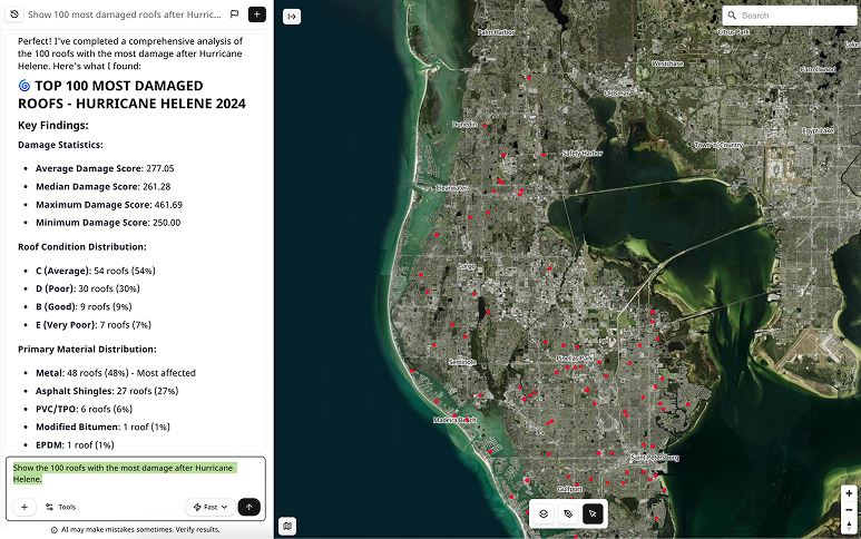
Simactive, the developer of Correlator3D, an end-to-end photogrammetry software, creates high-quality data from aerial (or sometimes satellite) imagery and UAVs. A new integration in Correlator3D will utilize lidar for registration, replacing traditional and time-consuming ground control points (GCP).
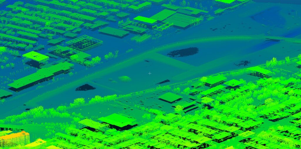
Correlator3D performs aerial triangulation and produces dense digital surface models, digital terrain models, point clouds, orthomosaics, 3D models and vectorized 3D features.
The new workflow allows users to import a point cloud into Correlator3D and perform registration with an image dataset. Using lidar as control eliminates the need for traditional ground control points when processing the photos. The registration step occurs during triangulation, which provides information necessary for a precise alignment of the images with the lidar scan. The output from Correlator3D can then be viewed either as colorized point clouds or seamless orthomosaics.
Image Processing as a Service
SimActive has been working to simplify and improve outputs for image processing in more ways than just improving workflows. In June, SimActive announced a drone data processing service that allows for clients to upload full projects and have SimActive experts generate optimal results from their imagery.
As opposed to common cloud-based solutions where outputs are generated automatically and delivered as-is, the new offering includes quality control by photogrammetry specialists. Manual tagging of ground control points is also performed as part of the service. There has not been an announcement as to whether the new workflow (that eliminates these GCPs) will be folded into this service based on the new announcement.