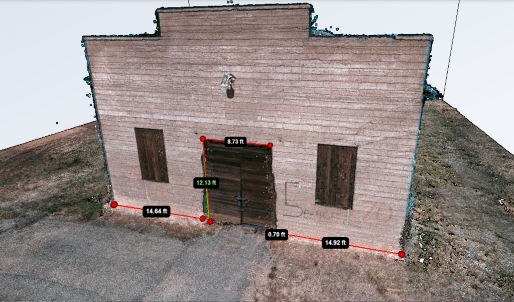

In this Geo Week interview with Tomaž Izak of 3DSurvey, we discuss the difficulties of the processing step for surveyors, what sparked the creation of the first software built “by surveyors, for surveyors” and get a demonstration of some of the newest features on the platform.
For more information on 3DSurvey’s tools and software, visit 3dsurvey.si