
Blurring the Line between Surveyors and End-Users
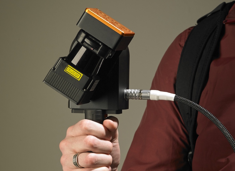
Since the ZEB-REVO has improved on the ZEB1’s resolution (and saved users from the weird experience of nodding a wobbly stick around) Reid says that surveyors are starting to buy in. The new device still doesn’t give users millimeter accuracy—but it is good enough for many projects and very fast to work with. It can also be used to cover difficult areas, since the results can also be tied into static scans where necessary.
Reid, however, is more excited about a different trend. “We’re seeing the actual end-user say, ‘Well this is so simple to do, that we can do it ourselves, and we don’t need to use the survey company.’ We’re seeing a big trend of end-users starting to look at the technology—whether it be construction, real-estate valuations, or what have you—and using it directly when traditionally they would have to go to a survey company.”
When I asked Reid how the ZEB-REVO compares to the mapping backpacks that have become popular lately, he answered that the main difference is end-user potential. “Backpacks,” he said, “still have relatively high complexity and cost, so they appeal mainly to the mainstream survey industry.” In other words, their focus is on producing the highest-accuracy results rather than being easy or affordable enough to appeal to end-users.
Since mobile mapping will never “achieve the exact same kind of accuracies that you get with a terrestrial scanner,” Reid told me, GeoSLAM has focused on offering these efficiencies in a package that will appeal to the general public. They have focused on getting the same speed as the backpack, but with a mix of “balanced performance, ease of use, versatility, and cost-effectiveness” that appeals to the greatest possible group of people.
You might call the ZEB-REVO an entry-level scanner for the end-user.