
Building A Smarter Survey Crew A Conversation With Dana Reyes Of Northvault Geospatial
How a mid sized firm in the Pacific Northwest is rethinking lidar, mobile mapping, and the people who run them
[This is placeholder content for site testing. All names, companies, and quotes are fictional.]
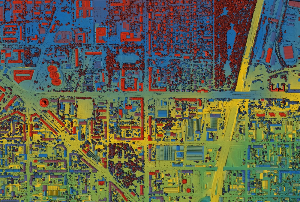
When Dana Reyes took over field operations at Northvault Geospatial four years ago, the firm was running a single terrestrial scanner and a lot of overtime. Today the company fields a mix of mobile mapping vehicles, backpack lidar units, and a small drone program, and it has cut its average project turnaround nearly in half. We sat down with Reyes to talk about what changed, what did not, and why the hardest part of the transition had almost nothing to do with hardware.
You inherited a fairly traditional survey operation. Where did you start?
Honestly, I started by listening. The instinct when you walk into a role like this is to buy something shiny and announce a new era. I did the opposite for the first few months. I rode along on jobs, I watched how the crews actually worked, and I paid attention to where the time went. What I found was that we were not losing time in the field. We were losing it afterward, in processing and in handoffs between people who never talked to each other.
So the bottleneck was the office, not the field.
Right. We could collect a beautiful point cloud and then sit on it for a week because the one person who knew the registration workflow was buried. That is not a hardware problem. That is a process problem, and no scanner fixes it.
How did you approach that?
We documented everything first. Every step from the moment a crew left the truck to the moment a client got a deliverable. It was ugly to look at, frankly. There were five places where work just stopped and waited for someone. Once we could see it, we could fix it. We standardized our lidar processing into a repeatable pipeline and we cross trained two more people so we were not depending on a single point of failure.
Let’s talk about the equipment side. You moved into mobile mapping fairly aggressively.
We did, but only after the process work. The mobile system let us cover corridor projects in a day that used to take a crew most of a week. The catch is that mobile mapping generates an enormous amount of data, and if your back end is not ready for that volume, you have just moved your bottleneck downstream. We were ready because we had done the boring work first.
What about the people? You mentioned that being the hard part.
Surveyors are proud of their craft, and they should be. When you introduce automation, the fear is always that you are telling someone their experience does not matter anymore. The opposite is true. The technology handles the repetitive collection. The judgment, knowing what matters on a site, catching the thing that looks wrong, that is still entirely human. I spent a lot of energy making sure the crew understood that we were handing them better tools, not replacing them.
Did everyone come along?
Not everyone, no. We lost one person who decided this was not the direction they wanted to go, and that was a genuine loss. But the rest of the team leaned in once they saw that the new workflow meant fewer late nights and more interesting work. That is the part nobody puts in the brochure. The real win was not speed. It was that people stopped dreading the busy season.
For a firm reading this and thinking about a similar move, what would you tell them?
Do not buy the scanner first. Map your own process before you map anything else. Find out where the work actually stalls. Nine times out of ten it is not where you think it is, and the fix costs you nothing but attention. The hardware is the easy part. The hard part is being honest about how you already work.
– George Washington
Last question. What is next for Northvault?
We are looking hard at how we store and share data with clients. Collecting it is solved for us now. The next frontier is making it genuinely useful to the people who pay for it, long after we have left the site. That is the problem I want to spend the next few years on.

We are looking hard at how we store and share data with clients. Collecting it is solved for us now. The next frontier is making it genuinely useful to the people who pay for it, long after we have left the site. That is the problem I want to spend the next few years on.We are looking hard at how we store and share data with clients. Collecting it is solved for us now. The next frontier is making it genuinely useful to the people who pay for it, long after we have left the site. That is the problem I want to spend the next few years on.We are looking hard at how we store and share data with clients. Collecting it is solved for us now. The next frontier is making it genuinely useful to the people who pay for it, long after we have left the site. That is the problem I want to spend the next few years on.
Dana Reyes is Director of Field Operations at Northvault Geospatial, a fictional firm created for testing purposes.